Tour du Grand Paradis
A high circuit through the valleys of Italy's Gran Paradiso National Park
The Tour du Grand Paradis links the high valleys around Italy's first national park, circling beneath the Gran Paradiso massif through refuges, passes and quiet Cogne and Valsavarenche trails.
150 km · 8,000 m ascent · 6 stages · 7–10 days · T5 · Italy
About the Tour du Grand Paradis
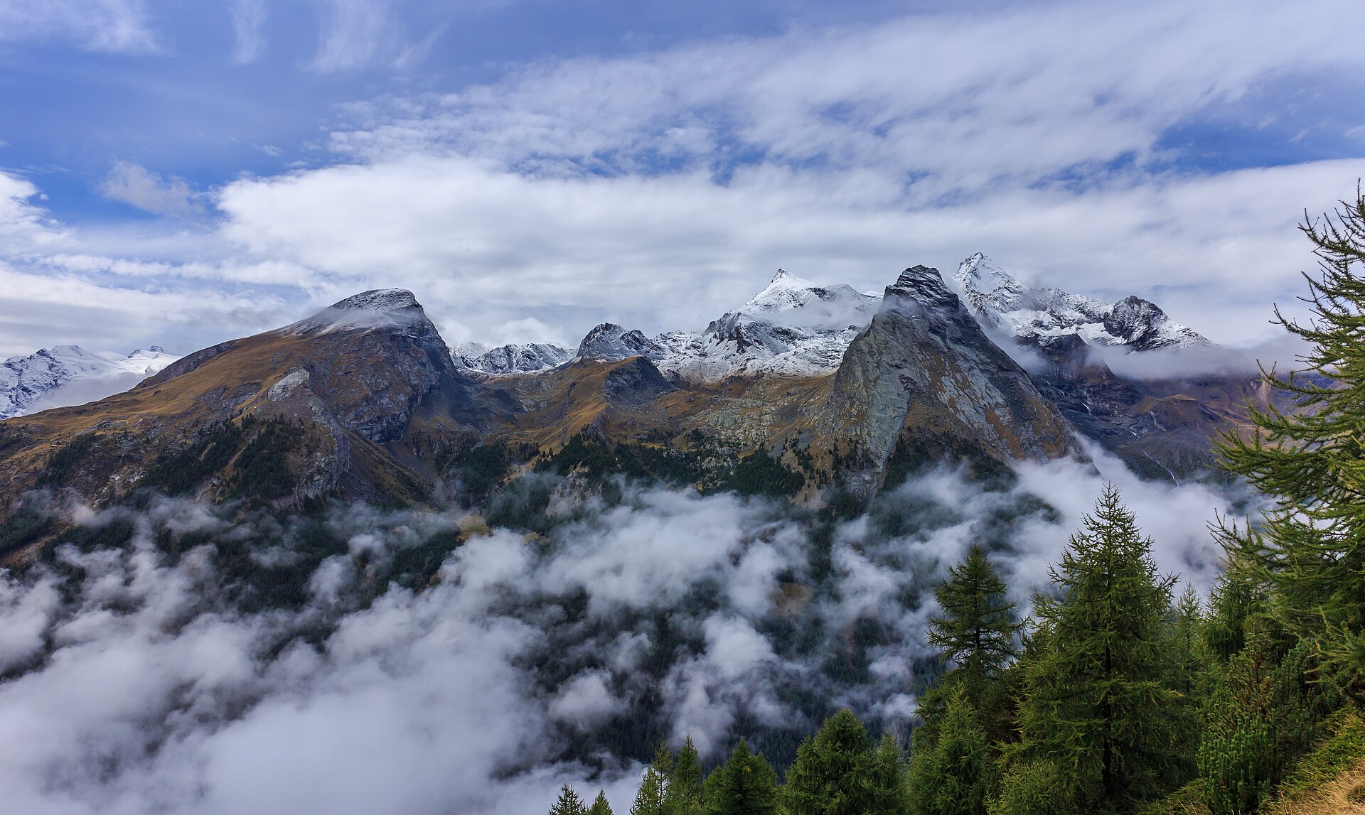
This high circuit moves from Pont in Valsavarenche toward the Col du Nivolet, across the Cogne valleys and back beneath Gran Paradiso through a chain of refuges and high passes.
The route sits in a protected landscape but is not a low-risk walk. The stored line reaches high, rough terrain, and several days are shaped by passes, old snow and long descents between the park's valleys.
Seven to ten days gives enough space to use the huts intelligently and add a shorter day around Cogne. Strong parties can move faster, but a slower plan makes the weather and the park itself much easier to read.
Gran Paradiso's glaciers and summit routes are a separate mountaineering world. The hiking circuit offers the terrain context around them without turning the walking line into a summit claim.
The 6 classic stages
Stage 1: Pont to Col du Nivolet
Pont - Valsavarenche to Col du Nivolet · 25.5 km · 1,360 m ascent · 1,360 m descent · T5
Climb from the Valsavarenche trailhead toward the broad high pass and the open views across Gran Paradiso country.
Stage 2: Col du Nivolet to Vittorio Emanuele II
Col du Nivolet to Refuge Vittorio Emanuele II · 25.5 km · 1,360 m ascent · 1,360 m descent · T5
Cross the high interior beneath the summit routes, with the park's glacier landscape setting the rhythm.
Stage 3: Vittorio Emanuele II to Cogne
Refuge Vittorio Emanuele II to Cogne · 25.5 km · 1,360 m ascent · 1,360 m descent · T5
Descend and traverse toward Cogne, trading high rock for the long valley and its refuge network.
Stage 4: Cogne to Colle della Terra
Cogne to Colle della Terra · 25.5 km · 1,360 m ascent · 1,360 m descent · T5
Return to the high country through the eastern valleys and the passes above the park's long glacial basins.
Stage 5: Colle della Terra to Valnontey
Colle della Terra to Cogne - Valnontey · 24 km · 1,280 m ascent · 1,280 m descent · T5
A rugged high traverse toward Valnontey, with rough ground and big views across the Cogne side.
Stage 6: Valnontey to Pont
Cogne - Valnontey to Pont - Valsavarenche · 24 km · 1,280 m ascent · 1,280 m descent · T5
Close the circuit through the final valleys and return to the Pont trailhead beneath the Gran Paradiso massif.
Refuges, gîtes and huts on the circuit
- km 7.1 — Refuge Chivasso, 2,604 m, 38 beds (stage 1)
- km 7.1 — Rifugio Savoia, 2,534 m, 50 beds (stage 1)
- km 17.0 — Bivacco Giraudo, 2,620 m (stage 2)
- km 21.2 — Rifugio Gran Piano, 2,222 m (stage 2)
- km 27.2 — Bivouac Ivrea, 2,745 m (stage 2)
- km 32.5 — Refuge Pontese, 2,217 m, 70 people beds (stage 3)
- km 32.5 — Rifugio Pontese, 2,200 m, 70 beds (stage 3)
- km 35.8 — Rifugio Meneghello, 2,440 m (stage 3)
- km 43.0 — Bivacco Gino Revelli, 2,600 m (stage 4)
- km 46.2 — Bivacco Davito, 2,360 m (stage 4)
- km 49.4 — Bivacco Devis Gérard, 2,780 m (stage 4)
- km 65.3 — Refuge Vittorio Sella, 2,584 m, 150 people beds (stage 5)
- km 65.3 — Rifugio Vittorio Sella, 2,588 m, 150 beds (stage 5)
- km 74.7 — Refuge Chabod, 2,750 m, 85 people beds (stage 6)
- km 74.7 — Rifugio Federico Chabod, 2,710 m, 85 beds (stage 6)
- km 74.7 — Locale invernale Rifugio Chabod, —, 33 beds (stage 6)
- km 77.9 — Refuge Vittorio Emanuele II, 2,735 m, 120 people beds (stage 6)
- km 77.9 — Rifugio Vittorio Emanuele II Nuovo, 2,735 m, 120 beds (stage 6)
- km 79.8 — Rifugio Tetras Lyre, 1,996 m, 41 beds (stage 6)
Cols on the classic line
- Col du Nivolet — 2,612 m (stage 1)
- Colle della Terra — 2,911 m (stage 1)
- Colle della Porta — 3,009 m (stage 2)
- Boccheta del Ges — 2,692 m (stage 2)
- Col dei Becchi — 2,990 m (stage 3)
- Boccheta di Valsoera — 2,683 m (stage 3)
- Colle di Ciardonei — 3,152 m (stage 3)
- Colle Valletta o Finestra — 2,465 m (stage 4)
- Col de Bardoney — 2,833 m (stage 4)
- Passage du Grand Neyron — 3,252 m (stage 6)
Know before you go
- The high summer window is the practical season; check the latest snow and refuge conditions before committing to the passes.
- The national park has rules for wildlife, dogs, camping and access. Read the current park guidance before departure.
- High huts can be busy and valley transport is limited. Reserve the critical nights and plan the approach and exit.
- Weather can close the highest crossings while the Cogne valley remains inviting. Keep a lower route in reserve.
- Do not confuse the hiking tour with the technical Gran Paradiso summit route; they require different equipment and decisions.
Frequently asked questions
How long is the Tour du Grand Paradis?
The stored circuit is about 150 km with roughly 8,000 m of ascent. Most parties allow seven to ten days.
Does the Tour du Grand Paradis climb the summit?
No. This page describes the high hiking circuit around the massif. The Gran Paradiso summit is a separate glaciated mountaineering route.
When should you walk the Tour du Grand Paradis?
Use the summer hiking season after checking the year's snow, pass and refuge conditions.
Where does the circuit go?
It links the Valsavarenche, Cogne and surrounding valleys inside and around Gran Paradiso National Park.
More multi-day routes
- Aiguilles Rouges Circuit — 50 km, 6 stages
- Alta Via 1 — 113 km, 8 stages
- Alta Via 2 — 159 km, 7 stages
- Alta Via dei Silenzi — 180 km, 7 stages
- Grand Tour du Chambeyron — 70 km, 5 stages
- Haute Route Bernoise — 57 km, 4 stages
- Haute Route Chamonix–Zermatt — 210 km, 10 stages
- Sentiero Roma — 40 km, 4 stages
- Tour des Combins — 95 km, 6 stages
- Tour des Écrins — 194 km, 5 stages
- Tour des Glaciers de la Vanoise — 54 km, 6 stages
- Tour du Beaufortain — 94 km, 6 stages
- Tour du Mont Blanc — 155 km, 10 stages
- Tour du Mont Viso — 43 km, 4 stages
- Tour du Queyras (GR 58) — 104 km, 7 stages
Sources and provenance
Stage metrics, tracks, huts and passes come from the Traverse route database. Conditions change: verify refuge opening, pass conditions and transport before you go.
Page reviewed .