Grand Tour du Chambeyron
Five days between the Ubaye and the Val Maira, on both sides of the border
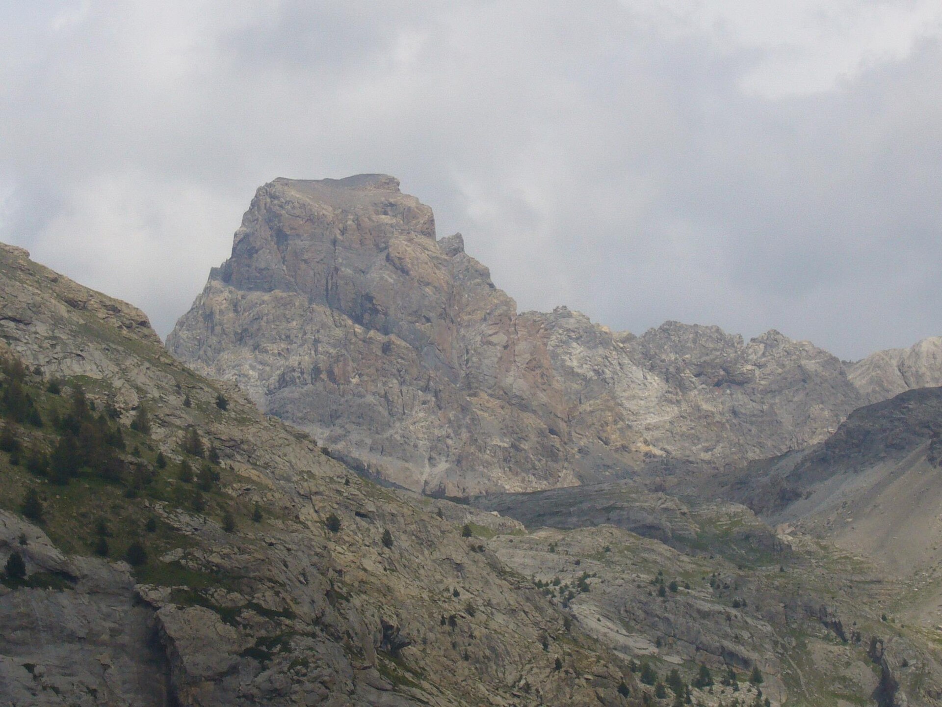
The Chambeyron is the wild corner of the southern Alps: 3,000 m granite towers, a string of high lakes, and villages on the Italian side that time forgot. The tour circles the massif in five stages, crossing the border twice and sleeping in refuges, bivouacs and mountain hamlets.
70 km · 5,160 m ascent · 5 stages · 5–6 days · T4 · France, Italy
About the Grand Tour du Chambeyron
From Maljasset at the head of the Ubaye, the circuit crosses to Chiappera in the Val Maira, works south through Chialvetta and the Italian hamlets, returns to France at Larche, and climbs back over the Col de Mallemort and the Pas de la Couleta to the Chambeyron refuge and its lakes.
The record grades it T4 and the stage profile shows why: four of the five days climb more than 1,100 m, and the cols — Scaletta, Enchiausa, Mallemort, Couleta — are all above 2,500 m.
Accommodation is a mix: staffed refuges at Chambeyron and Stroppia, gîtes in the Italian hamlets, and unstaffed bivouacs — Marinet, Barenghi, Bonelli, Valmaggia, Sartore — for parties carrying a sleeping bag. That mix is what makes the tour feel remote despite being short.
The Lac des Neuf Couleurs below the Brec is the set piece: nine shades of blue at 2,840 m, an hour above the Chambeyron refuge and worth the detour on the last stage.
The 5 classic stages
Stage 1: Larche to Refuge du Chambeyron
Larche to Refuge du Chambeyron · 12.6 km · 1,540 m ascent · 320 m descent · T4
Out of the Ubayette over the Col de Mallemort and the Col du Vallonnet, past the Aoupets shepherd's hut and over the Pas de la Couleta at 2,752 m to the Chambeyron refuge below the Brec.
Stage 2: Chambeyron to Marinet
Refuge du Chambeyron to Refuge Bivouac de Marinet · 12.2 km · 910 m ascent · 980 m descent · T4
Past the Lac des Neuf Couleurs at 2,840 m and the Bivacco Barenghi, across the Colle dell'Infernetto into Italy and back over the Col de Marinet to the Marinet bivouac.
Stage 3: Marinet to Chiappera
Refuge Bivouac de Marinet to Chiappera · 13.9 km · 360 m ascent · 1,270 m descent · T4
The long Italian traverse down towards the Stroppia waterfall and the upper Val Maira, finishing at Chiappera under the Rocca Provenzale.
Stage 4: Chiappera to Valmaggia
Chiappera to Bivacco Angelo Valmaggia · 10.8 km · 1,130 m ascent · 440 m descent · T4
Up past the Lago Visaisa and the Bivacco Bonelli to the Col d'Enchiausa at 2,740 m, then along the frontier ridge to the Valmaggia bivouac.
Stage 5: Valmaggia to Larche
Bivacco Angelo Valmaggia to Larche · 19.9 km · 1,220 m ascent · 1,740 m descent · T4
Back into France over the Col de Scaletta at 2,614 m, past the Lac and Col de Ruburent, then the long descent of the Rouchouse valley to Larche.
Refuges, gîtes and huts on the circuit
- km 5.6 — Cabane du Vallonet, — (stage 1)
- km 9.2 — Bergerie du Vallon des Aoupets, 2,465 m (stage 1)
- km 11.6 — Refuge du Chambeyron, 2,626 m, 69 beds (stage 1)
- km 16.4 — Bivouac Barenghi, 2,815 m (stage 2)
- km 23.0 — Refuge Bivouac de Marinet, 2,560 m (stage 2)
- km 34.6 — Rifugio di Stroppia, 2,260 m, 12 beds (stage 3)
- km 36.5 — Rifugio Campeggio Campo Base, 1,650 m, 32 beds (stage 3)
- km 43.1 — Bivacco Bonelli, 2,323 m (stage 4)
- km 45.5 — Bivacco Enrico e Mario, 2,650 m (stage 4)
- km 46.4 — Bivacco Angelo Valmaggia, 2,335 m (stage 4)
- km 61.8 — Cabane de Viraysse, 2,279 m (stage 5)
Cols on the classic line
- Col de Mallemort — 2,558 m (stage 1)
- Col du Vallonnet — 2,524 m (stage 1)
- Pas de la Couleta — 2,752 m (stage 1)
- Colle dell Infernetto — 2,783 m (stage 2)
- Col de Marinet — 2,787 m (stage 2)
- Col d'Enchiausa — 2,740 m (stage 4)
- Col de Scaletta — 2,614 m (stage 5)
- Col de Ruburent — 2,502 m (stage 5)
Know before you go
- July to mid-September. The cols hold snow late for a southern massif, and the Italian bivouacs are only realistic in settled weather.
- Half of the accommodation is unstaffed. Check which nights are refuge nights and which need a sleeping bag and food.
- The Italian hamlets — Chiappera, Chialvetta, Viviere — have gîtes and small inns, but few beds. Book ahead in August.
- Two border crossings, two phone networks and two currencies in practice: carry cash for the Italian side.
- Water is easy on the French side and scarcer on the long Italian traverses.
- The via ferrata delle Alpini near Chiappera is a popular rest-day add-on for parties with the kit.
Frequently asked questions
How long is the Grand Tour du Chambeyron?
About 70 km over five stages, with roughly 5,200 m of ascent. Most parties take five or six days depending on whether they add the Brec or the Neuf Couleurs lakes.
How hard is the Grand Tour du Chambeyron?
The record grades it T4. There is no technical climbing, but the cols are high and stony, four stages climb over 1,100 m, and several nights can be in unstaffed bivouacs.
Where does the Grand Tour du Chambeyron start?
Maljasset, at the head of the Ubaye valley above Saint-Paul-sur-Ubaye, is the usual start and finish. Chiappera in the Italian Val Maira is the other common trailhead.
When is the best time to walk it?
July to mid-September. Earlier and the cols hold snow; later and the Italian gîtes and the refuges start to close.
More multi-day routes
- Aiguilles Rouges Circuit — 50 km, 6 stages
- Alta Via 1 — 113 km, 8 stages
- Alta Via 2 — 159 km, 7 stages
- Alta Via dei Silenzi — 180 km, 7 stages
- Haute Route Bernoise — 57 km, 4 stages
- Haute Route Chamonix–Zermatt — 210 km, 10 stages
- Sentiero Roma — 40 km, 4 stages
- Tour des Combins — 95 km, 6 stages
- Tour des Écrins — 194 km, 5 stages
- Tour des Glaciers de la Vanoise — 54 km, 6 stages
- Tour du Beaufortain — 94 km, 6 stages
- Tour du Grand Paradis — 150 km, 6 stages
- Tour du Mont Blanc — 155 km, 10 stages
- Tour du Mont Viso — 43 km, 4 stages
- Tour du Queyras (GR 58) — 104 km, 7 stages
Sources and provenance
Stage metrics, tracks, huts and passes come from the Traverse route database. Conditions change: verify refuge opening, pass conditions and transport before you go.
Page reviewed .