Tour du Beaufortain
A hut-to-hut circuit through the green valleys and limestone passes of Savoie
The Tour du Beaufortain circles the pastoral massif east of Albertville, linking high lakes, working mountain chalets and limestone passes with views toward the Mont Blanc range.
94 km · 5,680 m ascent · 6 stages · 6–9 days · · France
About the Tour du Beaufortain
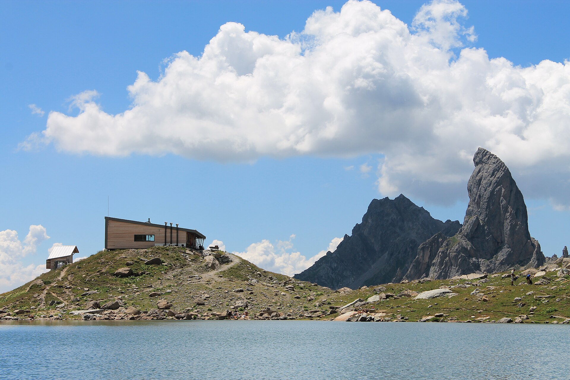
The Tour du Beaufortain makes a broad circuit through Savoie, crossing from the valley villages to high passes, pastoral plateaux and the refuge country around the Pierra Menta.
The Beaufortain is one of the Alps' great hut-to-hut landscapes for walkers who want real elevation without a fully glaciated route. The path repeatedly moves between forests, working alpages and high limestone ground, with Mont Blanc appearing across the eastern horizon.
Six to nine days is a useful range. The classic line can be walked in a week by strong parties, while a slower version makes room for the refuges, local food and weather decisions that give the circuit its character.
The valleys are more inhabited than the map's big skyline suggests. That makes the route flexible, but it also means the best itinerary is the one built around current transport, refuge openings and a realistic daily ascent.
The 6 classic stages
Stage 1: Beaufortain trailhead to Col du Bresson
Beaufortain trailhead to Col du Bresson · 16 km · 965.6 m ascent · 864.62 m descent
Leave the valley through pasture and forest toward the first high ground and the Pierra Menta country.
Stage 2: Col du Bresson to Presset
Col du Bresson to Refuge de Presset · 16 km · 965.6 m ascent · 864.62 m descent
Cross the heart of the massif, with the refuge and lake beneath the most recognisable rock skyline of the loop.
Stage 3: Presset to Croix du Bonhomme
Refuge de Presset to Col de la Croix du Bonhomme · 16 km · 965.6 m ascent · 864.62 m descent
A high traverse toward the TMB country, keeping the route's quiet Beaufortain character above the valleys.
Stage 4: Croix du Bonhomme to Col du Joly
Col de la Croix du Bonhomme to Col du Joly · 16 km · 965.6 m ascent · 864.62 m descent
Turn west and follow the broad balcony toward the Mont Blanc-facing side of the circuit.
Stage 5: Col du Joly to Col de la Forclaz
Col du Joly to Col de la Forclaz · 15 km · 908.8 m ascent · 813.76 m descent
A rolling stage through alpages and open ridges, with the valley villages below and the high peaks beyond.
Stage 6: Col de la Forclaz to the trailhead
Col de la Forclaz to Beaufortain trailhead · 15 km · 908.8 m ascent · 813.76 m descent
Close the loop through the final valleys and return to the Beaufortain trailhead.
Refuges, gîtes and huts on the circuit
- km 6.5 — Refuge du Lachat, —, 50 beds (stage 1)
- km 12.3 — Cabane de Cohennoz, — (stage 1)
- km 13.5 — Refuge de Varzeron, — (stage 1)
- km 14.7 — Cabane du Lac des Saisies, — (stage 1)
- km 26.3 — Les Mozes, 1,620 m (stage 2)
- km 33.5 — Chalet du Soufflet, 1,816 m, 6 beds (stage 2)
- km 35.4 — Refuge les Arolles, — (stage 2)
- km 46.4 — Refuge de l'Écondu, — (stage 3)
- km 48.9 — Refuge de la Coire, 2,062 m (stage 3)
- km 56.5 — Refuge de Presset, 2,514 m, 30 beds (stage 3)
- km 68.2 — Refuge du Col de la Croix du Bonhomme, 2,443 m, 99 beds (stage 4)
- km 72.6 — Refuge de la Balme, 1,706 m (stage 4)
- km 73.9 — Refuge des prés, — (stage 4)
- km 76.8 — Refuge La Roselette, 1,873 m, 28 beds (stage 4)
- km 84.3 — Refuge de la Croix de Pierre, — (stage 5)
- km 85.4 — Refuge Alpage de Bellastat, — (stage 5)
Cols on the classic line
Know before you go
- June to September is the standard window; high passes can still be snowy in early season.
- The circuit crosses working pasture. Keep dogs controlled, close gates and give livestock and shepherds space.
- Refuges and gîtes are the natural rhythm. Book popular nights before committing to a direction.
- The route climbs and descends repeatedly. Distance alone understates the effort, especially on warm valley days.
- Use the valley road network as a fallback, not as an assumption that every high stage has an easy exit.
Frequently asked questions
How long is the Tour du Beaufortain?
The stored circuit is about 94 km. Most walkers take six to nine days depending on the chosen refuges and how many stages they merge.
Is the Tour du Beaufortain suitable for beginners?
It is a non-technical alpine hike, but the repeated climbs, high passes and changing weather demand good fitness and mountain judgment.
When should you walk the Beaufortain?
June to September is typical, subject to snow on the passes and the operating dates of refuges and gîtes.
What is the highlight of the Tour du Beaufortain?
The route combines pastoral valleys and working chalets with high passes and the dramatic Pierra Menta and Mont Blanc views.
More multi-day routes
- Aiguilles Rouges Circuit — 50 km, 6 stages
- Alta Via 1 — 113 km, 8 stages
- Alta Via 2 — 159 km, 7 stages
- Alta Via dei Silenzi — 180 km, 7 stages
- Grand Tour du Chambeyron — 70 km, 5 stages
- Haute Route Bernoise — 57 km, 4 stages
- Haute Route Chamonix–Zermatt — 210 km, 10 stages
- Sentiero Roma — 40 km, 4 stages
- Tour des Combins — 95 km, 6 stages
- Tour des Écrins — 194 km, 5 stages
- Tour des Glaciers de la Vanoise — 54 km, 6 stages
- Tour du Grand Paradis — 150 km, 6 stages
- Tour du Mont Blanc — 155 km, 10 stages
- Tour du Mont Viso — 43 km, 4 stages
- Tour du Queyras (GR 58) — 104 km, 7 stages
Sources and provenance
Stage metrics, tracks, huts and passes come from the Traverse route database. Conditions change: verify refuge opening, pass conditions and transport before you go.
Page reviewed .