Alta Via dei Silenzi
The quiet high route across the eastern Dolomites from Vittorio Veneto to Sappada
Alta Via dei Silenzi crosses the eastern Dolomites from the Veneto foothills toward Sappada, linking quiet valleys, remote bivouacs and limestone passes away from the busiest hut routes.
180 km · 9,000 m ascent · 7 stages · 10–14 days · T4 · Italy
About Alta Via dei Silenzi
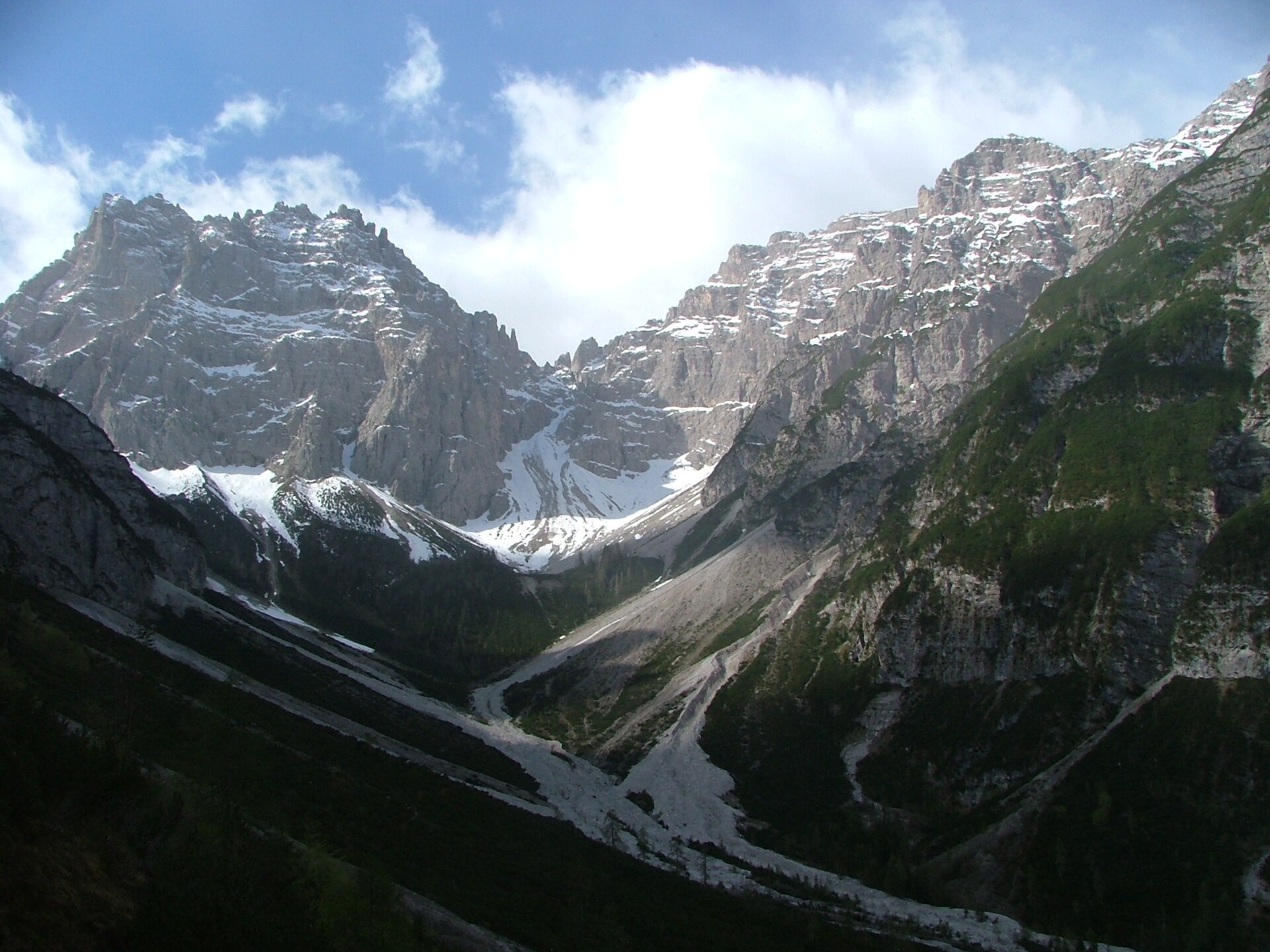
The Alta Via dei Silenzi runs north through the less-visited eastern Dolomites, leaving Vittorio Veneto for the wild groups around Col Nudo, Cimolais, Forni and Sappada.
The name is the point: this is a long, quiet route through a complicated mountain landscape where the stages are less standardised than on Alta Via 1. Expect long approaches, small refuges and a stronger need to understand the map before starting.
Ten to fourteen days is a sensible planning range. Some parties use valley transport to shorten access or exit sections, while others keep the full traverse for a deeper Dolomites crossing.
The eastern groups are not less mountainous because they are less famous. Check the pass conditions, confirm every hut and keep the route offline before leaving the last reliable signal.
The 7 classic stages
Stage 1: Vittorio Veneto to Col Indes
Vittorio Veneto to Col Indes · 23.4 km · 1,170 m ascent · 1,300 m descent · T4
Leave the Veneto foothills and climb toward the first high ground of the eastern Dolomites.
Stage 2: Col Indes to Cimolais
Col Indes to Cimolais · 25.2 km · 1,260 m ascent · 1,400 m descent · T4
Enter the wilder limestone groups around Col Nudo and descend to the quiet Cimolais valley.
Stage 3: Cimolais to Rifugio Giaf
Cimolais to Rifugio Giaf · 25.2 km · 1,260 m ascent · 1,400 m descent · T4
Move north through remote basins and passes toward the refuge network above Forni.
Stage 4: Giaf to Rifugio Padova
Rifugio Giaf to Rifugio Padova · 25.2 km · 1,260 m ascent · 1,400 m descent · T4
Traverse the high eastern Dolomites through rough limestone terrain and small refuge stages.
Stage 5: Padova to Rifugio De Gasperi
Rifugio Padova to Rifugio Fratelli De Gasperi · 25.2 km · 1,260 m ascent · 1,400 m descent · T4
Continue north across the quieter groups, with long views and fewer easy exits.
Stage 6: De Gasperi to Sappada
Rifugio Fratelli De Gasperi to Sappada · 27 km · 1,350 m ascent · 1,500 m descent · T4
Drop toward Sappada after the high Passo Elbel country and the final remote ridges.
Stage 7: Sappada to Sorgenti del Piave
Sappada to Rifugio Sorgenti del Piave · 28.8 km · 1,440 m ascent · 1,600 m descent · T4
A final high valley section around the Piave headwaters, useful as an alternate finish or extension.
Refuges, gîtes and huts on the circuit
- km 0.0 — Rifugio Sorgenti del Piave, 1,830 m, 14 people beds (stage 1)
- km 6.6 — Rifugio 2000 Berghütte, 2,002 m (stage 1)
- km 8.3 — Rifugio Monte Ferro, 1,563 m (stage 1)
- km 19.3 — Rifugio Fratelli De Gasperi, 1,767 m, 108 people beds (stage 2)
- km 30.2 — Rifugio Tenente Fabbro, 1,780 m (stage 2)
- km 46.9 — Rifugio Giaf, 1,400 m (stage 3)
- km 52.3 — Rifugio Padova, 1,300 m, 24 beds (stage 3)
- km 57.1 — Bivacco Giusto Gervasutti, 1,940 m (stage 3)
- km 61.2 — Bivacco Casera Laghét de Sora, 1,871 m (stage 4)
- km 65.5 — Bivacco Greselìn, 1,920 m (stage 4)
- km 68.2 — Rifugio Maniago, 1,730 m, 20 beds (stage 4)
- km 72.0 — Rifugio Cava Buscada, — (stage 4)
- km 72.6 — Rifugio Casera Mela, — (stage 4)
- km 110.5 — Casera Pian de le Stele, — (stage 6)
- km 113.5 — Rifugio Carlo Semenza, 2,020 m (stage 6)
- km 134.5 — Rifugio Città di Vittorio Veneto, — (stage 7)
Cols on the classic line
- Passo del Mulo — 2,356 m (stage 1)
- Passo Elbel — 1,963 m (stage 1)
- Forcella Scodovacca — 2,060 m (stage 3)
Know before you go
- Plan for a long summer window and verify snow on the northern passes before setting out.
- Hut and bivouac availability is thinner than on Alta Via 1. Carry a realistic overnight and food plan.
- Some stretches are remote and the exits are not quick. Share the route and a weather fallback with someone at home.
- Water sources can be seasonal. Filter and carry enough for dry limestone stages.
- Use the route as a planning line, then confirm local closures, forestry work and refuge access before each stage.
Frequently asked questions
How long is Alta Via dei Silenzi?
The stored route is about 180 km. Most parties take ten to fourteen days depending on access, hut openings and the chosen stage length.
Is Alta Via dei Silenzi remote?
Yes. It crosses quieter eastern Dolomite groups with fewer services and more self-sufficient stages than the headline Alta Vie.
Where does Alta Via dei Silenzi start and finish?
The line runs from the Veneto foothills around Vittorio Veneto north toward Sappada and the Carnic side of the Dolomites.
When should you walk it?
Use the settled summer season and check every pass and refuge because the route is more remote and less standardised than the busiest Dolomite classics.
More multi-day routes
- Aiguilles Rouges Circuit — 50 km, 6 stages
- Alta Via 1 — 113 km, 8 stages
- Alta Via 2 — 159 km, 7 stages
- Grand Tour du Chambeyron — 70 km, 5 stages
- Haute Route Bernoise — 57 km, 4 stages
- Haute Route Chamonix–Zermatt — 210 km, 10 stages
- Sentiero Roma — 40 km, 4 stages
- Tour des Combins — 95 km, 6 stages
- Tour des Écrins — 194 km, 5 stages
- Tour des Glaciers de la Vanoise — 54 km, 6 stages
- Tour du Beaufortain — 94 km, 6 stages
- Tour du Grand Paradis — 150 km, 6 stages
- Tour du Mont Blanc — 155 km, 10 stages
- Tour du Mont Viso — 43 km, 4 stages
- Tour du Queyras (GR 58) — 104 km, 7 stages
Sources and provenance
Stage metrics, tracks, huts and passes come from the Traverse route database. Conditions change: verify refuge opening, pass conditions and transport before you go.
Page reviewed .