Tour des Écrins
The GR54 — the hardest of the great French tours
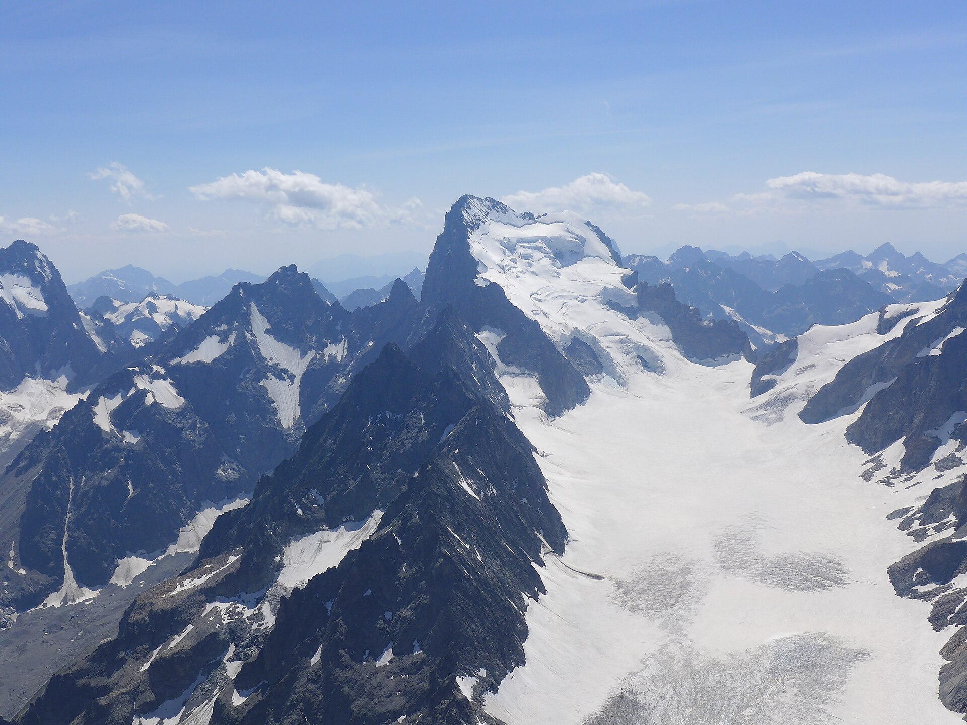
The Tour des Écrins circles the highest massif entirely in France, and it has a reputation: no cable cars, few shortcuts, and cols above 2,700 m one after another. The database record splits it into five long stages; most walkers spread the same ground over eight to twelve days.
194 km · 11,700 m ascent · 5 stages · 8–12 days · T4 · France
About the Tour des Écrins
The GR54 loops the Écrins national park through the Valgaudemar, the Vénéon, the Romanche, the Guisane and the Vallouise. It touches the Plateau d'Emparis under La Meije, crosses the Col d'Arsine and the Col de l'Aup Martin at 2,761 m, and drops into deep, quiet valleys between each pass.
It is the least forgiving of the classic French tours. The valleys are long, the cols are high, and there is nothing like the refuge density of the Tour du Mont Blanc — several stages commit you to a full day between beds. The record grades it T4.
The five stages here are the record's own split, and they are big: 34 to 44 km with up to 3,600 m of ascent. Most parties walk the same loop in eight to twelve days, breaking at the refuges de la Muzelle, Vallonpierre, Chabournéou, Souffles, Pré de la Chaumette and the Alpe de Villar d'Arène.
The circuit is walked in both directions from any of its trailheads — Le Bourg-d'Oisans, La Chapelle-en-Valgaudemar, Vallouise, Le Monêtier or Le Désert-en-Valjouffrey — and buses from Grenoble and Briançon reach most of them.
The 5 classic stages
Stage 1: Le Désert to Mizoën
Le Désert-en-Valjouffrey to Mizoën · 44 km · 3,615 m ascent · 3,490 m descent · T4
The hardest opening in the Alps: the Col de Côte Belle, the Col de la Muzelle and its lake, the Col du Vallon, then the descent to La Danchère and the climb over the GR50 to the Chambon reservoir.
Stage 2: Mizoën to the Alpe de Villar d'Arène
Mizoën to Refuge de l'Alpe de Villar d'Arène · 34 km · 2,353 m ascent · 1,280 m descent · T4
Up past Les Clots to the Plateau d'Emparis, the balcony under La Meije with the Lac Noir and Lac Lérié, then down to La Grave and up the Romanche to the Alpe refuge.
Stage 3: Villar d'Arène to Vallouise
Refuge de l'Alpe de Villar d'Arène to Vallouise · 35 km · 1,260 m ascent · 2,150 m descent · T4
The Col d'Arsine into the Guisane valley at Le Casset and Le Monêtier, then the Col de l'Eychauda and the long descent into the Vallouise.
Stage 4: Vallouise to Chabournéou
Vallouise to Refuge de Chabournéou · 44 km · 2,925 m ascent · 1,600 m descent · T4
The three-col day: Entre-les-Aigues, the Col de l'Aup Martin at 2,761 m, the Pas de la Cavale, the Pré de la Chaumette, then the Valette, Gouiran and Vallonpierre cols into the Valgaudemar.
Stage 5: Chabournéou to Le Désert
Refuge de Chabournéou to Le Désert-en-Valjouffrey · 38 km · 1,675 m ascent · 2,470 m descent · T4
Down the Valgaudemar to La Chapelle and Villar-Loubière, then the climb to the Refuge des Souffles and over the Col de la Vaurze to close the loop at Le Désert.
Refuges, gîtes and huts on the circuit
- km 10.6 — Refuge de la Muzelle, 2,130 m, 70 beds (stage 1)
- km 13.4 — Cabane de l'Embernard, — (stage 1)
- km 33.6 — Refuge des Clots, 1,540 m, 22 beds (stage 2)
- km 36.7 — Chalet-Refuge du Fay, —, 24 beds (stage 2)
- km 36.7 — Refuge des Mouterres, —, 25 beds (stage 2)
- km 43.9 — Refuge du Clos Raffin, — (stage 2)
- km 52.1 — Le Pas de l'Ane, — (stage 2)
- km 56.4 — Refuge de l'Alpe de Villar d'Arène, 2,071 m, 94 beds (stage 2)
- km 56.4 — Chalet-refuge de Chamoissière, 2,106 m, 25 beds (stage 2)
- km 56.4 — Chalet-Refuge de Chamoissière, 2,106 m (stage 2)
- km 84.2 — Chalet Alpin L'Eychauda, 1,267 m, 76 beds (stage 3)
- km 97.2 — Cabane du Jas Lacroix, 1,946 m (stage 4)
- km 104.3 — Refuge du Pré de la Chaumette, 1,805 m, 60 beds (stage 4)
- km 111.5 — Refuge de Vallonpierre, 2,271 m, 39 beds (stage 4)
- km 115.0 — Refuge de Chabournéou, 1,998 m, 40 beds (stage 4)
- km 119.9 — Refuge du Clot - Xavier Blanc, 1,397 m, 40 beds (stage 5)
- km 134.6 — Refuge des Souffles, 1,968 m, 30 beds (stage 5)
Cols on the classic line
- Col de Côte Belle — 2,290 m (stage 1)
- Col de la Muzelle — 2,613 m (stage 1)
- Col d'Arsine — 2,348 m (stage 3)
- Col de l'Eychauda — 2,425 m (stage 3)
- Col de l'Aup Martin — 2,761 m (stage 4)
- Pas de la Cavale — 2,731 m (stage 4)
- Col de la Valette — 2,671 m (stage 4)
- Col de Gouiran — 2,600 m (stage 4)
- Col de Vallonpierre — 2,607 m (stage 4)
- Col de la Vaurze — 2,500 m (stage 5)
Know before you go
- July to mid-September. The high cols hold snow into early summer and the refuges close around the middle of September.
- Refuges are further apart than on the Tour du Mont Blanc — check the next stage's beds before you commit to leaving a valley.
- The record's five stages are long. Splitting them at the intermediate refuges is the normal way to walk the loop.
- Water is plentiful in the valleys and scarce on the long col crossings; fill up before each climb.
- This is a national park: bivouacs are regulated, dogs are not allowed, and camping rules differ from the surrounding valleys.
- The Col de l'Aup Martin and the Pas de la Cavale are the most serious ground on the loop — steep, loose, and best avoided in a storm.
Frequently asked questions
How long is the Tour des Écrins (GR54)?
The catalogued loop is about 194 km with roughly 11,700 m of ascent. The database record splits it into five long stages; most walkers spread it across eight to twelve days using the intermediate refuges.
Is the GR54 harder than the Tour du Mont Blanc?
Yes. It is graded T4 against the TMB's T2: the cols are higher and looser, the valleys are longer, refuges are further apart, and there are far fewer lifts or buses to shorten a day.
When is the best time to walk the Tour des Écrins?
July to mid-September, once the high cols have cleared of snow and while the refuges are staffed. Early July can still mean snow on the Aup Martin and the Cavale.
Where does the Tour des Écrins start?
Anywhere on the loop. Le Bourg-d'Oisans, La Chapelle-en-Valgaudemar, Vallouise, Le Monêtier-les-Bains and Le Désert-en-Valjouffrey are all served by road and used as trailheads.
More multi-day routes
- Aiguilles Rouges Circuit — 50 km, 6 stages
- Alta Via 1 — 113 km, 8 stages
- Alta Via 2 — 159 km, 7 stages
- Alta Via dei Silenzi — 180 km, 7 stages
- Grand Tour du Chambeyron — 70 km, 5 stages
- Haute Route Bernoise — 57 km, 4 stages
- Haute Route Chamonix–Zermatt — 210 km, 10 stages
- Sentiero Roma — 40 km, 4 stages
- Tour des Combins — 95 km, 6 stages
- Tour des Glaciers de la Vanoise — 54 km, 6 stages
- Tour du Beaufortain — 94 km, 6 stages
- Tour du Grand Paradis — 150 km, 6 stages
- Tour du Mont Blanc — 155 km, 10 stages
- Tour du Mont Viso — 43 km, 4 stages
- Tour du Queyras (GR 58) — 104 km, 7 stages
Sources and provenance
Stage metrics, tracks, huts and passes come from the Traverse route database. Conditions change: verify refuge opening, pass conditions and transport before you go.
Page reviewed .