Sentiero Roma
A high traverse through the granite peaks and refuges of Val Masino
Sentiero Roma is a compact, high-level traverse through Val Masino, linking granite basins, alpine passes and celebrated refuges beneath the Bregaglia peaks.
40 km · 4,191 m ascent · 4 stages · 4–6 days · · Italy
About Sentiero Roma
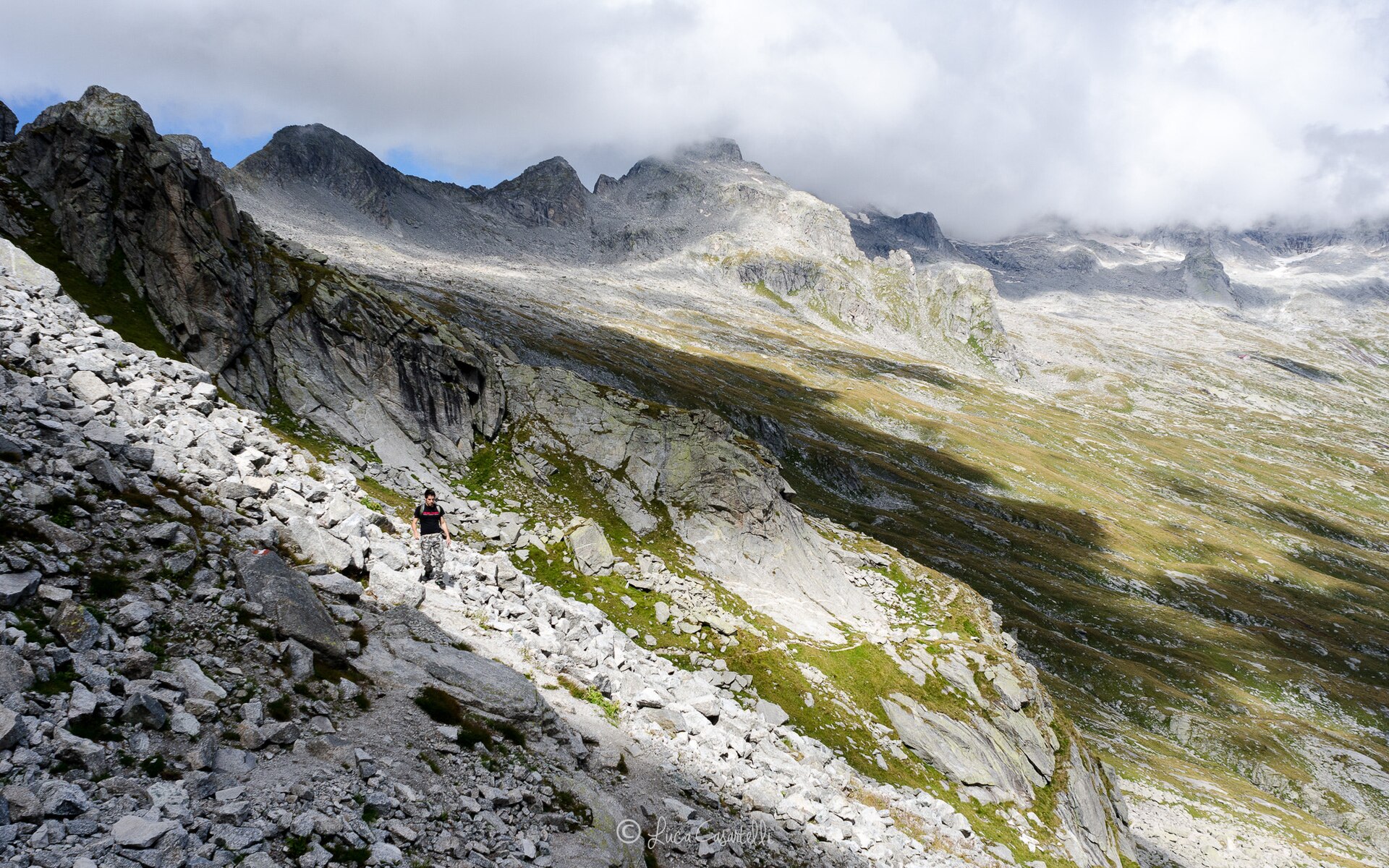
The Sentiero Roma traverses the high valleys above Val Masino, moving from the Lake Como side toward the Val Bodengo and the Rifugio Bosio-Galli beneath a wall of granite peaks.
The route is short on the map and serious underfoot. It is a high mountain path with exposed sections, old snow, steep gullies and refuge-to-refuge days that reward stable weather and confident movement on rough terrain.
Four days is a strong party's rhythm; five or six lets you keep the approaches and descents humane. The track here describes the established high traverse, while local variants and access paths can change the exact overnight plan.
This is the kind of route where a simple offline line is genuinely useful. Valleys fold away behind you, visibility can disappear in cloud, and the route's refuges are better anchors than road-based distance estimates.
The 4 classic stages
Stage 1: Novate Mezzola to Rifugio Brasca
Novate Mezzola to Rifugio Brasca · 10 km · 1,047.75 m ascent · 611.75 m descent
Climb from the lake-side approach into the first granite basin and the start of the high traverse.
Stage 2: Brasca to Gianetti
Rifugio Brasca to Rifugio Gianetti · 10 km · 1,047.75 m ascent · 611.75 m descent
Move deeper into the Bregaglia granite, crossing rough high ground below the great walls.
Stage 3: Gianetti to Allievi-Bonacossa
Rifugio Gianetti to Rifugio Allievi-Bonacossa · 10 km · 1,047.75 m ascent · 611.75 m descent
The traverse reaches its signature refuge country, with exposed paths and steep passes between the cirques.
Stage 4: Allievi-Bonacossa to Bosio-Galli
Rifugio Allievi-Bonacossa to Rifugio Bosio-Galli · 10 km · 1,047.75 m ascent · 611.75 m descent
Close the high line toward the Val Bodengo and the Bosio-Galli refuge beneath the final granite skyline.
Refuges, gîtes and huts on the circuit
- km 3.1 — La Locanda, 825 m, 60 beds (stage 1)
- km 3.2 — Osteria Alpina, — (stage 1)
- km 3.9 — Base Scout - La Centralina, — (stage 1)
- km 7.9 — Rifugio Bresciadega, 1,214 m (stage 1)
- km 9.0 — Base Scout - La Casera, 1,240 m (stage 1)
- km 9.8 — Rifugio Luigi Brasca, 1,303 m (stage 1)
- km 15.7 — Capanna Attilio Piacco, 2,538 m, 13 beds (stage 2)
- km 15.7 — Rifugio Luigi Gianetti, 2,534 m, 78 beds (stage 2)
- km 24.8 — Rifugio Bonacossa, 2,387 m, 70 beds (stage 3)
- km 24.9 — Rifugio Francesco Allievi, — (stage 3)
- km 34.6 — Rifugio Cesare Ponti, 2,559 m, 60 beds (stage 4)
- km 39.9 — Rifugio Bosio-Galli, 2,086 m, 50 beds (stage 4)
Cols on the classic line
Know before you go
- Use the main summer window and check snow and fixed-protection conditions before committing to the high traverse.
- The route is not a casual valley walk. Experience on exposed alpine paths and comfort with rough terrain are important.
- Refuges are limited and the classic stages book out. Confirm beds and opening dates before choosing a start date.
- Carry a real weather fallback. Retreating to the valley is often the correct decision when the passes close in.
- Some access and exit paths are long. Coordinate transport before the first high day.
Frequently asked questions
How long is Sentiero Roma?
The stored route is about 40 km, but the terrain makes the effort much greater than the distance suggests. Most parties take four to six days with access and exit time.
Is Sentiero Roma difficult?
It is a serious high-level alpine hike with exposure, rough ground and rapidly changing conditions. It is not technical climbing, but it is not a beginner's trail.
When should you walk Sentiero Roma?
Walk it in the settled summer season after checking snow, protection and refuge conditions for the specific year.
Where does Sentiero Roma go?
The traverse runs through the high valleys of Val Masino in northern Italy, linking the Lake Como side with the refuges toward Val Bodengo.
More multi-day routes
- Aiguilles Rouges Circuit — 50 km, 6 stages
- Alta Via 1 — 113 km, 8 stages
- Alta Via 2 — 159 km, 7 stages
- Alta Via dei Silenzi — 180 km, 7 stages
- Grand Tour du Chambeyron — 70 km, 5 stages
- Haute Route Bernoise — 57 km, 4 stages
- Haute Route Chamonix–Zermatt — 210 km, 10 stages
- Tour des Combins — 95 km, 6 stages
- Tour des Écrins — 194 km, 5 stages
- Tour des Glaciers de la Vanoise — 54 km, 6 stages
- Tour du Beaufortain — 94 km, 6 stages
- Tour du Grand Paradis — 150 km, 6 stages
- Tour du Mont Blanc — 155 km, 10 stages
- Tour du Mont Viso — 43 km, 4 stages
- Tour du Queyras (GR 58) — 104 km, 7 stages
Sources and provenance
Stage metrics, tracks, huts and passes come from the Traverse route database. Conditions change: verify refuge opening, pass conditions and transport before you go.
Page reviewed .