Aiguilles Rouges Circuit
A high balcony loop above Chamonix, the Arve valley and Mont Blanc
The Aiguilles Rouges Circuit links Lac Blanc, the Col des Montets, Anterne and the Brévent balconies for a concentrated high-level view of Mont Blanc and the Chamonix valley.
50 km · 5,238 m ascent · 6 stages · 4–6 days · T3 · France
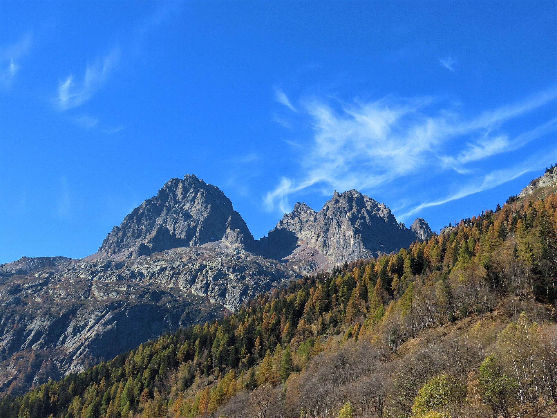
About the Aiguilles Rouges Circuit
The circuit stays on the north side of the Chamonix valley, linking the Lac Blanc and Anterne sectors with high balconies, refuges and some of the closest walking views toward Mont Blanc.
The route is short enough for a long weekend but rich enough for a full mountain trip. It moves between engineered balcony paths, rough passes, lake basins and refuge approaches where the granite skyline can fill the entire horizon.
Four to six days is a realistic range, with lifts and valley transport creating several possible start points. That flexibility helps with weather, but the exposed balcony sections still deserve an early start and a clear decision about the next pass.
Lac Blanc is famous for a reason, yet the quieter Anterne and Loriaz sections are what make the circuit feel like a route rather than a viewpoint tour.
The 6 classic stages
Stage 1: Lac Blanc to Col des Montets
Lac Blanc to Col des Montets · 8.5 km · 890.46 m ascent · 891.14 m descent · T3
Leave the famous lake and traverse north through the Chéserys and Bérard country toward the Col des Montets.
Stage 2: Col des Montets to Moëde Anterne
Col des Montets to Refuge de Moëde Anterne · 8.5 km · 890.46 m ascent · 891.14 m descent · T3
Climb back into the Aiguilles Rouges toward the Anterne basin and its high refuge.
Stage 3: Moëde Anterne to Brévent
Refuge de Moëde Anterne to Le Brévent · 8.5 km · 890.46 m ascent · 891.14 m descent · T3
Cross the broad high ground above the Arve valley with Mont Blanc directly across the way.
Stage 4: Brévent to Bellachat
Le Brévent to Refuge de Bellachat · 8.5 km · 890.46 m ascent · 891.14 m descent · T3
Follow the dramatic balcony south above Chamonix, with steep drops and a close view of the massif.
Stage 5: Bellachat to Plan Praz
Refuge de Bellachat to Plan Praz · 8 km · 838.08 m ascent · 838.72 m descent · T3
Keep the high balcony or descend toward the lift station as weather and transport dictate.
Stage 6: Plan Praz to Lac Blanc
Plan Praz to Lac Blanc · 8 km · 838.08 m ascent · 838.72 m descent · T3
Close the circuit across the Flégère side and return to the Lac Blanc basin.
Refuges, gîtes and huts on the circuit
- km 5.0 — Refuge du Lac Blanc, 2,350 m, 40 beds (stage 1)
- km 18.6 — Refuge de Bellachat, 2,152 m, 18 beds (stage 3)
- km 29.6 — Refuge de Moëde Anterne, 2,002 m, 91 beds (stage 4)
- km 35.5 — Abri de Villy, 2,330 m, 2 beds (stage 5)
- km 39.1 — Refuge de la Pierre à Bérard, 1,922 m, 40 beds (stage 6)
- km 39.2 — Refuge de la Pierre à Bérard , 1,924 m, 40 beds (stage 6)
Cols on the classic line
- Col de la Glière — 2,461 m (stage 2)
- Col du Lac Cornu — 2,414 m (stage 2)
- Col du Brévent — 2,368 m (stage 3)
- Col de Salenton — 2,526 m (stage 5)
Know before you go
- Late June to September is typical. Check snow on the Col de Salenton and the opening dates of every refuge.
- The circuit sits above a busy valley but includes exposed paths and steep descents. Crowds do not remove the mountain risk.
- Lifts can change the best stage split and operating dates vary. Confirm the transport plan before relying on it.
- The Mont Blanc view is the reward, not a weather guarantee. Cloud can arrive quickly from the west.
- Use the map to keep a lower valley exit available when the high balcony is wet, snowy or crowded.
Frequently asked questions
How long is the Aiguilles Rouges Circuit?
The stored circuit is about 50 km. Most parties take four to six days, using lifts or valley access to adjust the start and finish.
Is the Aiguilles Rouges Circuit difficult?
It is a non-technical but high alpine circuit with steep paths, exposed balconies and passes that can hold snow.
Can you see Mont Blanc from the circuit?
Yes. The north-side balconies are famous for direct views across the Chamonix valley toward Mont Blanc and the surrounding glaciers when the weather is clear.
When should you walk it?
Late June to September is typical, subject to snow, refuge openings and lift operations.
More multi-day routes
- Alta Via 1 — 113 km, 8 stages
- Alta Via 2 — 159 km, 7 stages
- Alta Via dei Silenzi — 180 km, 7 stages
- Grand Tour du Chambeyron — 70 km, 5 stages
- Haute Route Bernoise — 57 km, 4 stages
- Haute Route Chamonix–Zermatt — 210 km, 10 stages
- Sentiero Roma — 40 km, 4 stages
- Tour des Combins — 95 km, 6 stages
- Tour des Écrins — 194 km, 5 stages
- Tour des Glaciers de la Vanoise — 54 km, 6 stages
- Tour du Beaufortain — 94 km, 6 stages
- Tour du Grand Paradis — 150 km, 6 stages
- Tour du Mont Blanc — 155 km, 10 stages
- Tour du Mont Viso — 43 km, 4 stages
- Tour du Queyras (GR 58) — 104 km, 7 stages
Sources and provenance
Stage metrics, tracks, huts and passes come from the Traverse route database. Conditions change: verify refuge opening, pass conditions and transport before you go.
Page reviewed .