Haute Route Bernoise
Four days around the Wildhorn, between the Valais and the Bernese Oberland
A compact, high circuit around the Wildhorn from the Col du Sanetsch, crossing between the Valais and the Bernese Oberland four times in four days. Short stages, big ground: limestone pavement, fixed ropes at the Col des Audannes and a hut every night.
57 km · 3,250 m ascent · 4 stages · 4 days · T4 · Switzerland
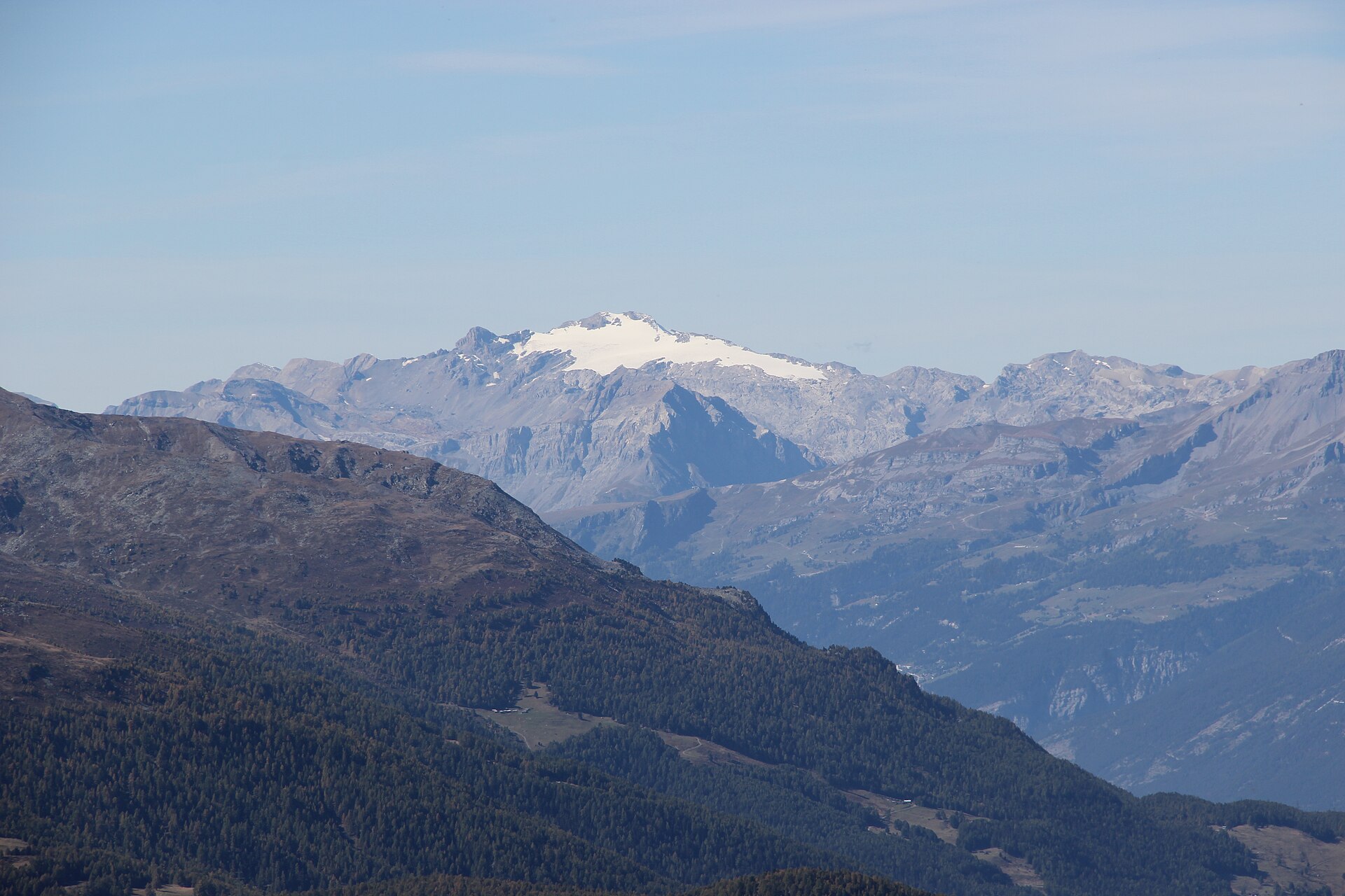
About the Haute Route Bernoise
The circuit starts and finishes at the Col du Sanetsch above Sion and runs anticlockwise around the Wildhorn: the Col des Audannes, the Col des Eaux Froides and the Rawil, the Iffigsee and the Wildhornhütte, the Geltenhütte, and a final crossing under the Arpelistock back to the Sanetsch.
Four stages, four Swiss Alpine Club huts, and roughly 3,250 m of climbing. The record grades it T4: there are fixed ropes and ladders on the Col des Audannes, a long stretch of karst pavement before Ténéhet where the cairns matter in poor visibility, and moraine on the closing stage.
It is the quiet alternative to the crowded Bernese Oberland classics. The huts — Audannes, Wildhorn, Gelten — are staffed in summer and rarely full, and the tour is short enough to fit into a long weekend.
August is the month. The record is explicit that late snow makes an early start on this circuit a mistake for anyone without alpine kit.
The 4 classic stages
Stage 1: Sanetsch to Cabane des Audannes
Col du Sanetsch to Cabane des Audannes · 9.3 km · 830 m ascent · 580 m descent · T4
From the pass along the Arête de l'Arpille and the Grand Gouilles to the Col des Audannes at 2,886 m — fixed ropes and ladders on the far side — then down to the hut.
Stage 2: Audannes to Iffigenalp
Cabane des Audannes to Iffigenalp · 12.9 km · 440 m ascent · 1,320 m descent · T4
Over the Col des Eaux Froides and across the limestone pavement above the Lac de Ténéhet to the Rawil pass, then the long descent past Stiereläger to the Iffigenalp.
Stage 3: Iffigenalp to Geltenhütte
Iffigenalp to Geltenhütte · 13.7 km · 1,060 m ascent · 680 m descent · T4
Up to the Iffigsee and the Wildhornhütte at 2,303 m, then the traverse under the Stigelschafberg — or the gentler Tungelpass — and down to the Geltenhütte above its waterfalls.
Stage 4: Geltenhütte to Sanetsch
Geltenhütte to Col du Sanetsch · 20.6 km · 1,310 m ascent · 1,070 m descent · T4
The closing stage through the Rottal and over the moraine below the Arpelistock, back along the Arête de l'Arpille to the Col du Sanetsch. Fair weather only.
Refuges, gîtes and huts on the circuit
- km 9.0 — Cabane des Audannes, 2,506 m, 46 beds (stage 1)
- km 18.6 — Blattlihütte, — (stage 2)
- km 20.2 — Iffigenalp, — (stage 2)
- km 26.1 — Wildhorn hut, 2,303 m, 96 beds (stage 3)
- km 33.2 — Cabane de Gelten CAS, 2,003 m, 70 beds (stage 3)
Cols on the classic line
- Col du Brochet — 2,753 m (stage 1)
- Col des Audannes — 2,886 m (stage 1)
- Col du Rawil — 2,429 m (stage 2)
Know before you go
- August is the recommended month — the névés on the high crossings persist well into the summer.
- The Col des Audannes has fixed ropes and ladders, and rockfall risk when several parties are on it. Space out.
- The karst pavement before Ténéhet is disorientating in fog. Follow the cairns and stow the poles for the crossing.
- Reach the start at the Col du Sanetsch by car or postbus from Sion; there is parking at the pass.
- Escape routes drop to the Tseuzier reservoir, Iffigenalp and Lauenen if the weather turns.
- The closing stage crosses moraine below the Arpelistock — ask the Geltenhütte warden about conditions before committing to it.
Frequently asked questions
How long is the Haute Route Bernoise?
About 58 km with roughly 3,250 m of ascent, walked in four stages from and back to the Col du Sanetsch. Each stage is four to seven hours.
How hard is the Tour du Wildhorn?
The record grades it T4. The distances are short, but there are fixed ropes and ladders at the Col des Audannes, karst pavement that demands careful navigation, and moraine on the final stage.
When can you walk the Haute Route Bernoise?
August is ideal. The route crosses several high cols that hold snow into midsummer, and the huts are staffed through the summer season only.
Where does the Haute Route Bernoise start?
At the Col du Sanetsch, reached by road or postbus from Sion in the Valais. There is parking at the pass and the circuit returns to the same point.
More multi-day routes
- Aiguilles Rouges Circuit — 50 km, 6 stages
- Alta Via 1 — 113 km, 8 stages
- Alta Via 2 — 159 km, 7 stages
- Alta Via dei Silenzi — 180 km, 7 stages
- Grand Tour du Chambeyron — 70 km, 5 stages
- Haute Route Chamonix–Zermatt — 210 km, 10 stages
- Sentiero Roma — 40 km, 4 stages
- Tour des Combins — 95 km, 6 stages
- Tour des Écrins — 194 km, 5 stages
- Tour des Glaciers de la Vanoise — 54 km, 6 stages
- Tour du Beaufortain — 94 km, 6 stages
- Tour du Grand Paradis — 150 km, 6 stages
- Tour du Mont Blanc — 155 km, 10 stages
- Tour du Mont Viso — 43 km, 4 stages
- Tour du Queyras (GR 58) — 104 km, 7 stages
Sources and provenance
Stage metrics, tracks, huts and passes come from the Traverse route database. Conditions change: verify refuge opening, pass conditions and transport before you go.
Page reviewed .