Haute Route Chamonix–Zermatt
The walkers' high road from Mont Blanc to the Matterhorn
The Haute Route links the two great mountain towns of the Alps on foot: out of Chamonix under Mont Blanc, over ten cols through the Valais, and down the Mattertal to arrive under the Matterhorn at Zermatt. This is the walkers' line — no rope, no glacier travel — but it is long, high and consistently serious.
210 km · 11,000 m ascent · 10 stages · 11–14 days · T4 · France, Switzerland
About the Haute Route
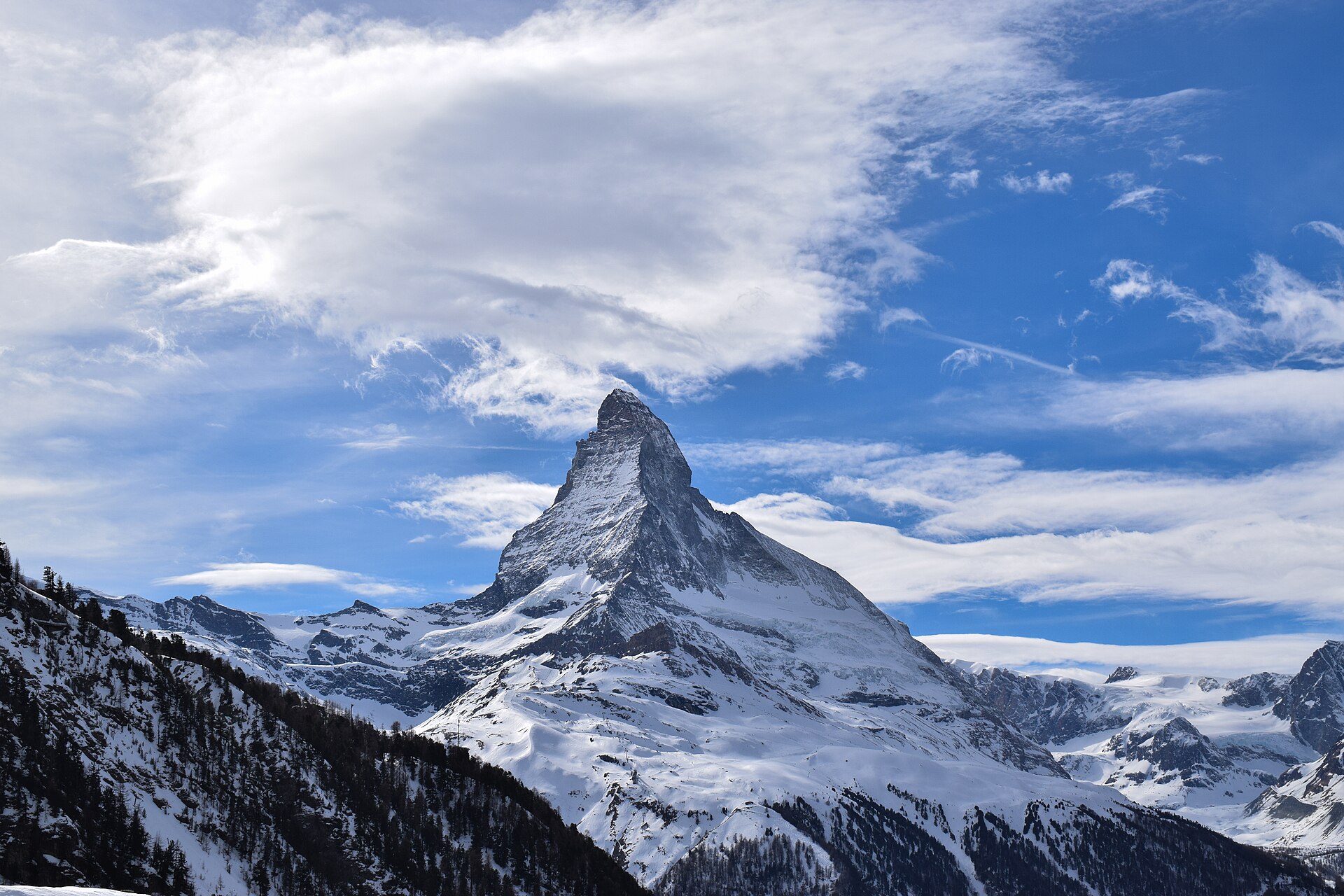
The original Haute Route was a ski traverse, first skied in 1911; the summer walkers' version follows the same idea on paths — Chamonix to Zermatt without a rope, crossing from the Mont Blanc massif into the Valais and finishing under the Matterhorn. The line here runs through Trient, Champex, the Val de Bagnes, Prafleuri, Arolla, La Sage, Zinal, Gruben and St Niklaus.
It is a serious walk rather than a technical one. The cols reach beyond 2,900 m, several are reached over moraine, boulders and old snow, and the biggest days climb more than 1,500 m. The database record grades the line T4: sure-footedness and a head for exposure matter more than any single move.
Most parties take 11 to 14 days. The stages below are the walking splits along the track; where a stage runs long — the Val de Bagnes climb, or the Europaweg above the Mattertal — many walkers break it at the Cabane du Mont Fort or the Europahütte instead.
The route is a traverse, not a loop, which makes logistics part of the planning: a train to Chamonix at one end, a train out of Zermatt at the other, and postbus links in the Val de Bagnes and the Val d'Hérens if weather or fatigue forces a shortcut.
The 10 classic stages
Stage 1: Chamonix to Trient
Chamonix-Mont-Blanc to Trient · 27.7 km · 2,240 m ascent · 1,940 m descent · T4
Up the Chamonix valley past Argentière and over the Col de Balme into Switzerland, with Mont Blanc filling the view behind you the whole way to the border.
Stage 2: Trient to Champex
Trient to Champex-Lac · 13.3 km · 1,340 m ascent · 1,190 m descent · T4
The Bovine path over the alp above Trient, or the Fenêtre d'Arpette for those who want the glacier view, dropping to the lake and hotels of Champex.
Stage 3: Champex to Le Châble
Champex-Lac to Le Châble · 17.5 km · 270 m ascent · 910 m descent · T4
A low, green transition day through Sembrancher and the Val de Bagnes farmland — the last easy walking before the route climbs into the high Valais.
Stage 4: Le Châble to Cabane de Prafleuri
Le Châble to Cabane de Prafleuri · 23.4 km · 2,570 m ascent · 760 m descent · T4
The big climb of the route: out of the valley past Verbier and the Cabane du Mont Fort, across the Col Termin and Col de Louvie balconies under the Grand Combin, then over the Col de Prafleuri to the hut.
Stage 5: Prafleuri to Arolla
Cabane de Prafleuri to Arolla · 21.8 km · 1,060 m ascent · 1,670 m descent · T4
Over the Col des Roux and along the Lac des Dix, then the loose climb to the Col de Riedmatten — or the ladders of the Pas de Chèvres — before the descent to Arolla.
Stage 6: Arolla to La Sage
Arolla to La Sage · 11.7 km · 460 m ascent · 800 m descent · T4
A shorter day down the Val d'Hérens past Les Haudères, with the Dent Blanche behind and the option of the Lac Bleu detour on the way to La Sage.
Stage 7: La Sage to Zinal
La Sage to Zinal · 21.8 km · 1,820 m ascent · 1,820 m descent · T4
Over the Col du Tsaté or the Col de Torrent into the Moiry valley, past the dam and the glacier terrace, then the Col de Sorebois and the long drop into Zinal.
Stage 8: Zinal to Gruben
Zinal to Gruben · 21.9 km · 1,400 m ascent · 1,250 m descent · T4
The Forcletta at 2,874 m carries the route out of the French-speaking Val d'Anniviers into the German-speaking Turtmanntal and the single hotel at Gruben.
Stage 9: Gruben to St Niklaus
Gruben to St Niklaus · 17.3 km · 1,110 m ascent · 1,790 m descent · T4
The Augstbordpass at 2,894 m, the highest col on the walkers' line, then a long descent through boulder fields and larch forest to the Mattertal at St Niklaus.
Stage 10: St Niklaus to Zermatt
St Niklaus to Zermatt · 33.9 km · 2,220 m ascent · 1,730 m descent · T4
The Europaweg balcony high above the Mattertal, past the Europahütte and the Charles Kuonen suspension bridge, with the Matterhorn appearing for the last hour into Zermatt.
Refuges, gîtes and huts on the circuit
- km 6.0 — La Flégère, — (stage 1)
- km 8.2 — Refuge du Lac Blanc, 2,352 m, 40 beds (stage 1)
- km 18.3 — Refuge du Col de Balme, 2,191 m (stage 1)
- km 22.8 — Refuge Le Peuty, —, 22 beds (stage 1)
- km 61.7 — Cabane Mont Fort, 2,457 m, 58 beds (stage 4)
- km 71.6 — Cabane de Prafleuri, 2,657 m (stage 5)
- km 73.6 — Cabane des Ecoulaies, 2,575 m, 22 beds (stage 5)
- km 74.2 — Cabane de la Barmaz, 2,458 m, 50 beds (stage 5)
- km 81.8 — Cabane des Dix, 2,928 m, 115 beds (stage 5)
- km 129.9 — Hôtel Weisshorn, 2,337 m (stage 8)
- km 163.9 — Europahütte, 2,220 m, 42 beds (stage 10)
- km 179.1 — Grünsee Mountain Lodge, 2,296 m (stage 10)
Cols on the classic line
- Col de Balme — 2,191 m (stage 1)
- Col de la Chaux — 2,940 m (stage 4)
- Col de Prafleuri — 2,987 m (stage 4)
- Pas de Chèvres — 2,855 m (stage 5)
- Col de Riedmatten — 2,919 m (stage 5)
- Col de Torrent — 2,920 m (stage 7)
- Col de Sorebois — 2,835 m (stage 7)
- Augstbordpass — 2,893 m (stage 9)
Know before you go
- Mid-July to mid-September is the window. Earlier and the high cols hold snow that turns the moraine crossings into a different proposition.
- Accommodation alternates between staffed Swiss Alpine Club cabanes and valley hotels or gîtes — reserve both, and reserve early for Prafleuri, Moiry and the Europahütte.
- Several stages have no shop or refill point between valleys. Carry the day's food from the last village rather than counting on a hut lunch.
- The Europaweg above the Mattertal is rockfall country and sections close after slides; check the current status before committing to the final stage.
- The line crosses two countries but stays in Switzerland after Trient, so plan Swiss francs, Swiss cards and Swiss transport passes.
- Bad weather is normally managed by dropping into a valley and using the postbus, not by pressing on over a 2,900 m col.
Frequently asked questions
How long is the Haute Route from Chamonix to Zermatt?
The walking line measured on this track is about 211 km with roughly 11,000 m of ascent, split here into ten stages. Most parties walk it in 11 to 14 days, using the valley transport links where a stage runs long.
How hard is the Haute Route?
The database record grades it T4. There is no glacier travel or roped climbing on the walkers' line, but the cols are high, several are approached over boulder fields and old snow, and the route asks for sure-footedness, fitness and settled weather.
Do you need a guide for the walkers' Haute Route?
Not for the standard summer line, which is waymarked throughout. A guide is worth considering early in the season, when snow lies on the cols, or if you want to link the route with the glacier variants.
When can you walk the Haute Route?
Mid-July to mid-September, once the high cols have cleared and while the Swiss Alpine Club cabanes are staffed. September brings the most stable weather and the quietest huts, but the season ends abruptly with the first autumn snow.
Where does the Haute Route start and finish?
It starts in Chamonix in France and finishes in Zermatt in Switzerland, crossing the Valais by way of Trient, Champex, the Val de Bagnes, Arolla, Zinal, Gruben and St Niklaus.
More multi-day routes
- Aiguilles Rouges Circuit — 50 km, 6 stages
- Alta Via 1 — 113 km, 8 stages
- Alta Via 2 — 159 km, 7 stages
- Alta Via dei Silenzi — 180 km, 7 stages
- Grand Tour du Chambeyron — 70 km, 5 stages
- Haute Route Bernoise — 57 km, 4 stages
- Sentiero Roma — 40 km, 4 stages
- Tour des Combins — 95 km, 6 stages
- Tour des Écrins — 194 km, 5 stages
- Tour des Glaciers de la Vanoise — 54 km, 6 stages
- Tour du Beaufortain — 94 km, 6 stages
- Tour du Grand Paradis — 150 km, 6 stages
- Tour du Mont Blanc — 155 km, 10 stages
- Tour du Mont Viso — 43 km, 4 stages
- Tour du Queyras (GR 58) — 104 km, 7 stages
Sources and provenance
Stage metrics, tracks, huts and passes come from the Traverse route database. Conditions change: verify refuge opening, pass conditions and transport before you go.
Page reviewed .