K2
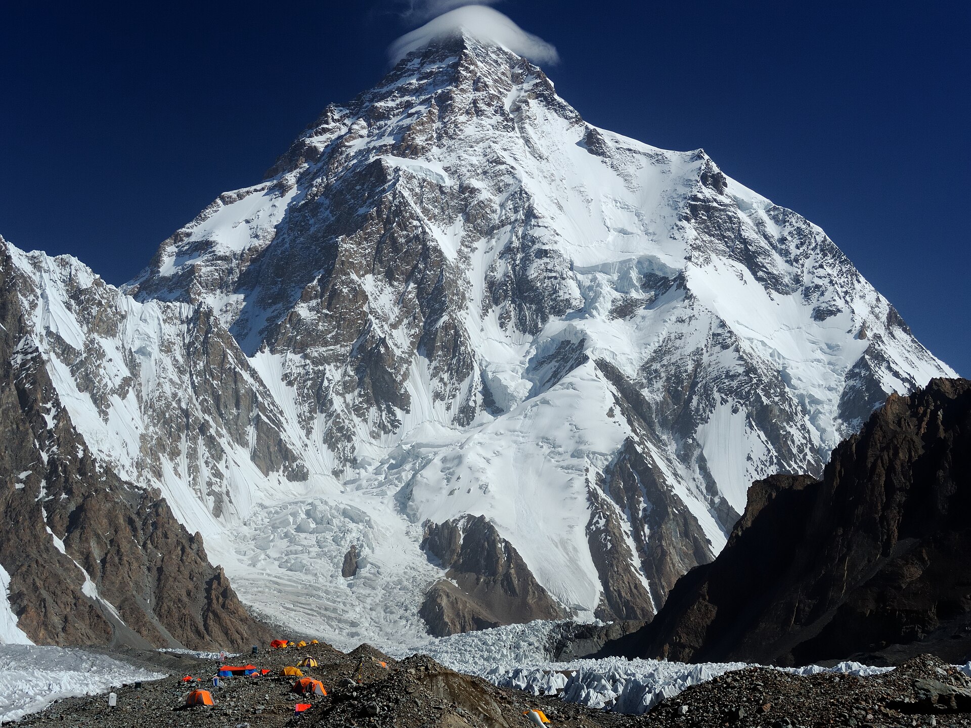
K2, also known as Mount Godwin-Austen, at 8,611 metres (28,251 ft) above sea level, is the second-highest mountain on Earth, after Mount Everest at 8,849 metres (29,032 ft). It lies in the Karakoram range, partially in the Gilgit-Baltistan region of Pakistan-administered Kashmir and partially in the China-administered Trans-Karakoram Tract in the Taxkorgan Tajik Autonomous County of Xinjiang.
- Elevation
- 8,611 m
- Prominence
- 4,020 m
- Coordinates
- 35.88111° N, 76.51333° E
- Range
- Baltoro Muztagh
- Region
- Taxkorgan Tajik Autonomous County, Pakistan
About K2
K2 is the world’s second-highest mountain, rising to 28,251 feet (8,611 metres) in the Karakoram Range on the China–Pakistan-administered Kashmir frontier . The mountain rises from about 15,000 feet on the Godwin Austen Glacier, a tributary of the Baltoro Glacier, and was surveyed in 1856 by T.G.
Open K2 in Traverse at 35.88111° N, 76.51333° E to inspect 8,611 m of relief, 4,020 m of prominence, and approaches around Taxkorgan Tajik Autonomous County, Pakistan on 3D terrain.
Documented mountaineering milestones
- 1856 — Survey and designation of the peak as K2 during the Survey of India’s Karakoram measurements: Col. T.G. Montgomerie
- 1902 — First recorded summit attempt, reaching approximately 18,600 feet on the northeastern crest: Anglo-Swiss expedition
- 1954 — First ascent via the Abruzzi Ridge: Achille Compagnoni and Lino Lacedelli, on an Italian expedition led by Ardito Desio
Routes and approaches
A recognised approach from the Pakistan side proceeds by a roughly 130-kilometre trek to Concordia, the junction of the Godwin-Austen, Vigne, Broad Peak, and West Gasherbrum glaciers, followed by access up the Godwin-Austen Glacier toward K2 Base Camp .
GPX-backed hiking and ski touring records near Taxkorgan Tajik Autonomous County from the Traverse catalog. Metrics appear only when the source provides them.
More mountains in Traverse
Sources and provenance
- Wikidata
- Wikipedia
- Wikimedia Commons image
- Google Trends comparison
- Historical or route context
- Historical or route context
- Historical or route context

Mountain information is factual reference only, not a current conditions or safety report.
Page reviewed .