Mount Shasta
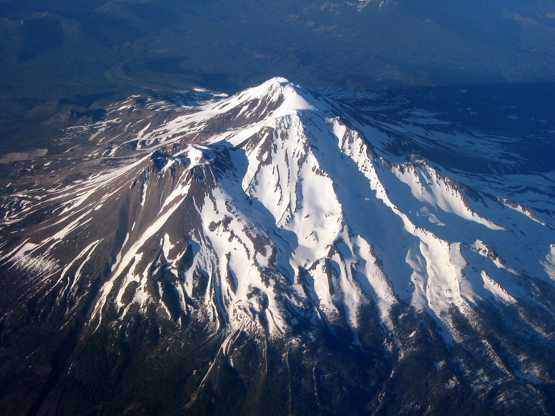
Mount Shasta is a potentially active stratovolcano at the southern end of the Cascade Range in Siskiyou County, California. At an elevation of 14,179 ft (4,322 m), it is the second-highest peak in the Cascades and the fifth-highest in the state.
- Elevation
- 4,322 m
- Prominence
- 2,977 m
- Coordinates
- 41.40920° N, 122.19489° W
- Range
- California Cascades
- Region
- Siskiyou County, United States
About Mount Shasta
Mount Shasta is a snow- and glacier-capped active volcano in northern California that rises 14,179 feet and is the highest peak in the Shasta-Trinity National Forest, the second-highest in the Cascades, and the fifth-highest in California . The Smithsonian Global Volcanism Program identifies Shasta as a complex stratovolcano composed of at least four overlapping volcanic edifices .
Open Mount Shasta in Traverse at 41.40920° N, 122.19489° W to inspect 4,322 m of relief, 2,977 m of prominence, and approaches around Siskiyou County, United States on 3D terrain.
Documented mountaineering milestones
- 1854 — First recorded ascent of Mount Shasta, by a party led by E. D. Pierce: E. D. Pierce and party
- 1874 — First of John Muir's documented Mount Shasta ascents: John Muir
- 1875 — Two further ascents, including an April ascent with Jerome Fay: John Muir and Jerome Fay
Routes and approaches
The U.S. Forest Service identifies Avalanche Gulch as a recognised south-side route, accessed from the Bunny Flat trailhead via the Everitt Memorial Highway, while noting that no trail reaches the summit .
GPX-backed hiking and ski touring records near Siskiyou County from the Traverse catalog. Metrics appear only when the source provides them.
More mountains in Traverse
Sources and provenance
- Wikidata
- Wikipedia
- Wikimedia Commons image
- Google Trends comparison
- Historical or route context
- Historical or route context
- Historical or route context
- Historical or route context

Mountain information is factual reference only, not a current conditions or safety report.
Page reviewed .