Mount Saint Elias
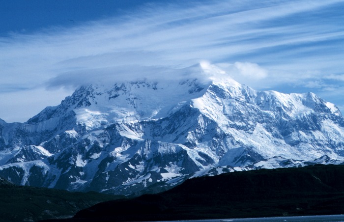
Mount Saint Elias is an 18,008 foot (5,489 m) mountain located approximately 11 miles (18 km) northeast of the Pacific Ocean on the Yukon-Alaska border. It is the second-highest mountain in both Canada and the United States, as well as in the Yukon and Alaska.
- Elevation
- 5,489 m
- Prominence
- 3,448 m
- Coordinates
- 60.29222° N, 140.93139° W
- Range
- Saint Elias Mountains
- Region
- Alaska, United States
About Mount Saint Elias
Mount Saint Elias, also known in Tlingit as Was'eitushaa, is a 18,008-foot (5,489-meter) peak of the tectonic Saint Elias Range in Wrangell–St. Elias National Park and Preserve, Alaska.
Open Mount Saint Elias in Traverse at 60.29222° N, 140.93139° W to inspect 5,489 m of relief, 3,448 m of prominence, and approaches around Alaska, United States on 3D terrain.
Documented mountaineering milestones
- 1897 — First ascent via the expedition route from the Malaspina and Newton Glacier area to Russell Col and the summit: Luigi Amedeo di Savoia-Aosta, Duke of Abruzzi, and expedition members including Vittorio Sella
- 1946 — Second ascent and first ascent from the south via the long south ridge: Harvard Mountaineering Club expedition
- 1965 — First ascent of the northwest ridge: Boyd N. Everett Jr., James Alt, Gordon Benner, Edwin Bernbaum, Joseph Davidson, Dennis Eberl, James Given, David Redmond, Leon Story, and William Van de Graaff
Routes and approaches
Recognized climbing approaches have used glacier travel and bush-plane access to high glacier camps, including approaches from the Tana River area or Columbus Glacier before joining routes toward Russell Col and the summit.
GPX-backed hiking and ski touring records near Alaska from the Traverse catalog. Metrics appear only when the source provides them.
More mountains in Traverse
Sources and provenance
- Wikidata
- Wikipedia
- Wikimedia Commons image
- Google Trends comparison
- Historical or route context
- Historical or route context
- Historical or route context
- Historical or route context

Mountain information is factual reference only, not a current conditions or safety report.
Page reviewed .